Watsonville Airport beacon tower.
Cingular (SF-734)
Sprint
36° 56.04´N, 121° 47.29´W,
(NAD27), 175 ft altitude by GPS.
On the rotating beacon tower by Aviation
Way off of Airport Blvd. Exit Highway 1 at
Airport Blvd., go away from the sea about
1 mile, enter Aviation Way loop.
Antenna appears to be 360°, 3 sector.
Tower height above ground ???
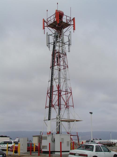
Airports are great places for cell sites,
they are flat and have a good view of the
surrounding land and there are less restrictions
as high objects are already there.

The equipment cabinets at Cingular's SF-734.